

backend.geobd.com
Editorial Pick
24 Articles
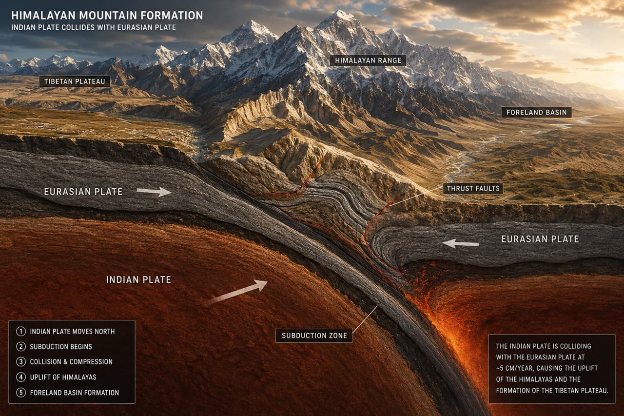

Plate Tectonics and the Indian–Eurasian Collision: Mapping South Asia’s Seismic Belt
4 min read4' read


Seismic Hazard Zoning in the Sylhet Trough: Reading the Fault Lines of Northeast Bangladesh
4 min read4' read


Geochemical Tracing of Himalayan Erosion Signals in Bay of Bengal Deep-Sea Sediments
4 min read4' read


Groundwater Depletion in the Barind Tract: Hydrogeological Crisis in Northwest Bangladesh
4 min read4' read

Natural Gas Exploration in the Chittagong Fold Belt: Bangladesh’s Subsurface Energy Frontier
4 min read4' read


Climate Change and Bangladesh: Shifting Monsoon Patterns, Extreme Heat and Rising Seas
4 min read4' read


Flash Floods of the Hakaluki Haor: Understanding Sudden Inundation in Sylhet’s Wetland Basin
4 min read4' read


Physiographic Divisions of Bangladesh: From Pleistocene Terraces to the Active Delta Front
4 min read4' read


Mobile GIS for Disaster Assessment: Field Data Collection During the 2024 Sylhet Floods
4 min read4' read


Thirty Years of Change: Satellite Image Analysis of Sundarbans Mangrove Cover 1990–2024
4 min read4' read


Discover Top Topics
Explore the most active topics across Bangladesh's geo-science community


Join the GeoBD Community
Get the latest geo-science articles, fieldwork stories, GIS tutorials, and career opportunities delivered to your inbox. Join Bangladesh’s growing geoscience network.- 01Free to join — create your author account.
- 02Publish blogs, share field stories & tutorials.
- 03Connect with geo professionals across Bangladesh.
